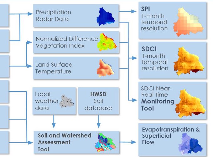
We used data from various Earth observing satellites and in situ stations to analyze and monitor the current state of meteorological and agricultural drought across the Arenal-Tempisque watershed using two indices. The Standardized Precipitation Index (SPI) was used to monitor meteorological drought and the Scaled Drought Condition Index (SDCI) was used to monitor agricultural drought. The team also created information for water balance assessment (modelling stream flow and evapotranspiration rates) using the Soil Water Assessment Tool (SWAT) model by combining NASA earth observations, ancillary data sources, and in situ data. More information: https://github.com/mariariveraaraya/NASA_drought_CR. Project video: https://www.youtube.com/watch?v=Y6nSwslxhaM&t=1s
Monitoring drought using satellite images in Costa Rica (NASA)
Monitoring drought using satellite images in Costa Rica (NASA)
Maria Rivera Araya
Cloud data specialist and educator
My interests include cloud technologies, data engineering and environmental science.